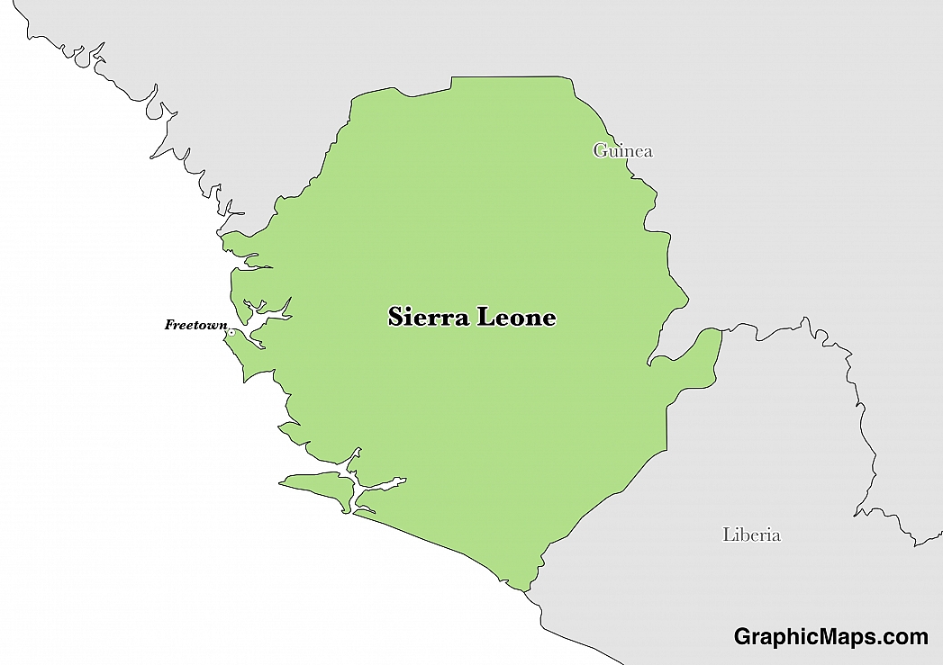
Where is Sierra Leone?
Located in Western Africa, Sierra Leone has a 1,093.00 km border with Guinea (794 km) and Liberia (299 km). It has a 402.00 km coastline. Sierra Leone opposes Guinean troops' continued occupation of the village of Yenga.
The capital city of Sierra Leone is Freetown, located on the western coastline of the country. This city is a major port for this area of the Atlantic Ocean and was settled in 1787. Freetown is considered the center for commerce, culture, education, and politics in Sierra Leone and the city's economy revolves around the deep harbour off the coast. During the 1990s, the city was the scene of intense violence during the Civil War of Sierra Leone. The climate of Freetown is considered a tropical environment with relatively high temperatures and humidity throughout the year. The rainy season occurs from May-October and sees close to 95% of the entire year's rainfall; approximately 2774 millimetres (109 inches) out of 2945 yearly millimetres (115 inches) of rain falls during this time of the year. The warmest months of the year occur from March-May with average highs reaching 31.2 degrees Celsius (88.2 degrees Fahrenheit). Average lows throughout the year rarely dip below 23 degrees Celsius (73.4 degrees Fahrenheit). Attractions in the city have been rebuilt after the costly civil war during the 1990s and Sierra Leone is a well-kept secret in terms of unique sites and picturesque scenery
Read more on Sierra Leone's CapitalSierra Leone is an African country covering 71,740.00 km2 of which 0.17% is water and 71,620.00 km2 is land. This makes it the 117th largest country in the world and slightly smaller than South Carolina. Its geographic coordinates are 8 30 N, 11 30 W and Freetown is the capital city.
The name Sierra Leone comes from the Portuguese explorer Pedro de Sintra.
Its ISO code is SL.
Geography
Sierra Leone has a mean elevation of 279 m above sea level.
It has a tropical climate with two monsoon seasons between December to March and June to September. Its terrain is made up of mangrove swamps, wooded hill country, plateaus, and mountains.
Population
Sierra Leone has a population of 6,018,888 making it the 109th largest in the world.
English is the official language, and Mende and Temne are widely spoken. The major ethnic groups reported are Temne, Mende, Limba and Kono. The majority of the population practices Islam or indigenous beliefs.
?The official language of Sierra Leone is English, however, the country is considered multilingual with several other languages taking precedent over English. Minority languages in Sierra Leone include Mende which is spoken natively by 37% of the population. Mende is spoken mainly in southern Sierra Leone with a small number of speakers in neighboring Liberia. Temne is spoken by roughly 30% of the population as a first language and evolved from the Niger-Congo family of languages. Although English is the official language of education, the government, and media, it remains a minority language in terms of native speakers and prevalence within the country. Approximately 97% of the 7.4 million citizens in the country speak the Krio language (either natively or as a second or third language) which evolved from English Creole. Krio provides a mutual method of communication between the various tribes and ethnic groups within Sierra Leone
Read more on Sierra Leone's LanguagesThe dialing code for the country is 232.
Government
Sierra Leone is an independent country. it gained independence from the United Kingdom in 1961. Its constitution was last ratified in 2008.
The political system of Sierra Leone takes place in an environment of a presidential representative republic. The parliament of Sierra Leone was founded in 1863 as a legislative council that would represent British interests in the colony. The President of Sierra Leone is considered both the head of government and head of state as well as appointing a Cabinet of Ministers which requires approval from parliament. The national parliament of the country is located in the capital city of Freetown, on the western coast. There are 124 members of parliament and 112 of these individuals are elected from the 14 districts in the country. The remaining 12 seats are reserved for Paramount Chiefs, who represent the highest level of regional authority in the nation's districts. The first decade of independence in Sierra Leone was known as the golden age and this was due to the evolution and work of the national parliament. Elections in Sierra Leone take place every five years. The voting system used in Sierra Leone is first-past-the-post, similar to that of Canada, India, Pakistan, the United Kingdom, and the United States.
Read more on Sierra Leone's GovernmentEconomy
Factoring in Purchasing Power Parity, Sierra Leone's GDP is $10,640,000,000.00 (USD) with $1,700.00 (USD) per capita. This makes it the 156th largest economy and its citizens the 204th richest in the world. The currency of Sierra Leone is the Leone (SLL).
Its major export partners are China, Belgium, and Romania. Its main exports are iron ore, diamonds, rutile, cocoa, coffee, and fish. Its major import partners are China, India, and the United States. Its major imports include foodstuffs, machinery, and fuels.
Flag
The flag of Sierra Leone consists of three equally sized horizontal bands of green, white, and blue (top to bottom). This flag was adopted as the official national banner on 27 April 1961, the same day the country gained independence from the United Kingdom. The flag was last officially confirmed by state law in the 1991 amendments to the national constitution. The flag of Sierra Leone is said to have derived from the national coat of arms that was created in 1960 in the lead up to independence. The College of Arms organization were the designers of this coat of arms and their work inspired the flag which was adopted around one year later. Chapter 1, Article 3 of the Sierra Leone Constitution states the design specifications in legal terms with guidelines as to how it can be displayed. Previous flags of Sierra Leone include two similar banners that were used while the country was considered a protectorate of the United Kingdom. The flag of Sierra Leone is said to have derived from the national coat of arms that was created in 1960 in the lead up to independence
Read more on Sierra Leone's FlagThis page was last modified on January 17th, 2018
More on Graphicmaps
Published on 2019-11-06
What is a Trade Embargo?
Published on 2019-11-04
Which Two Countries Used to Have the Same Flag?
Published on 2019-09-16
What Is the Only Two-Sided State Flag?
Published on 2019-09-16
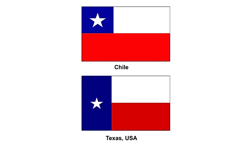
Which Country Flag Looks Like the Texas Flag?
Published on 2019-08-29
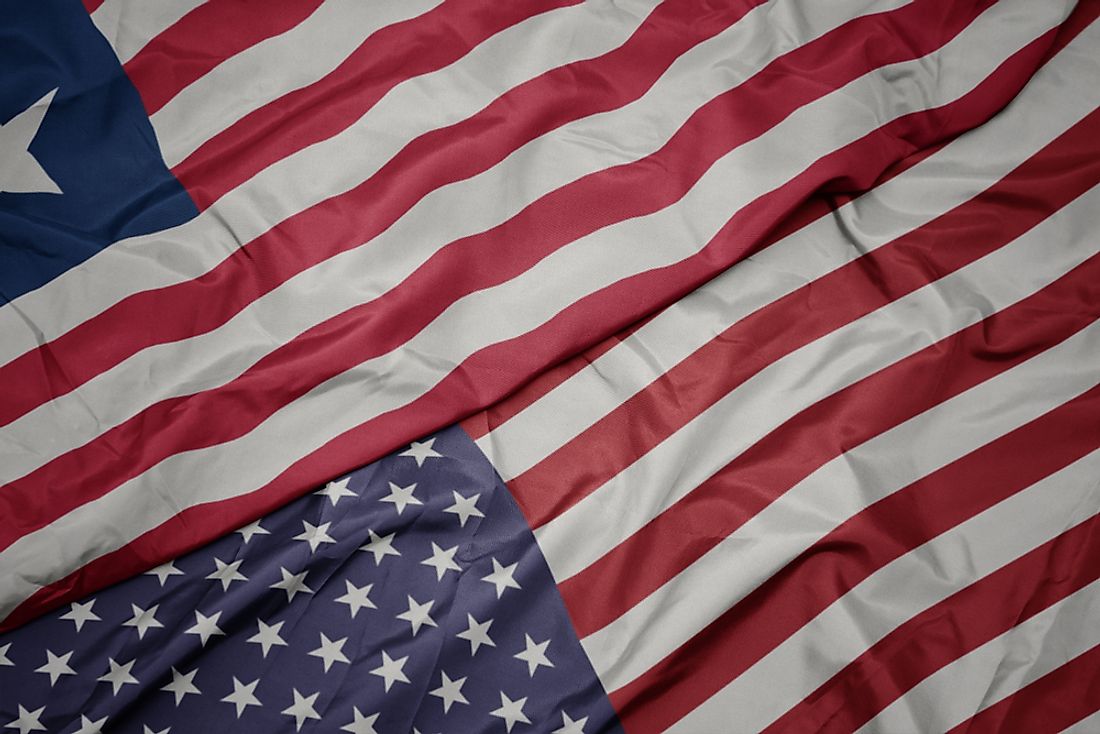
Flags That Resemble the US Flag
Published on 2019-08-20
