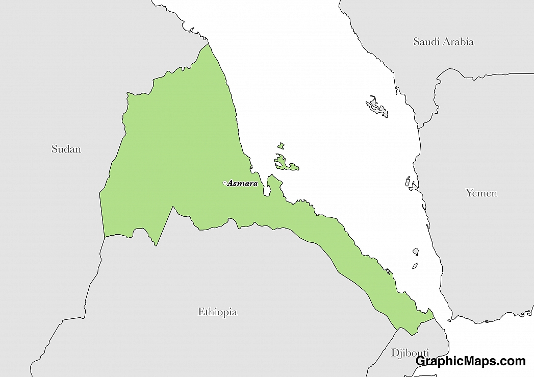
Where is Eritrea?
Located in Eastern Africa, Eritrea has a 1,840.00 km border with Djibouti (125 km), Ethiopia (1,033 km) and Sudan (682 km). It has a 2,234.00 km coastline. Eritrea and Ethiopia agreed to abide by the 2002 Ethiopia-Eritrea Boundary Comission's delimitation decision.
The capital city of Eritrea is Asmara, located in the centre of the country and around two hours drive from the coast of the Red Sea. The area has been inhabited for over 500 years by humans. The primary language in the city is Tigrinya although English and Italian are widely used and understood. The town is also well-known for the preservation of Italian colonial-era architecture. The population of Asmara city is approximately 804,000, but the metropolitan area of Asmara contains over 1.25 million inhabitants.
Read more on Eritrea's CapitalEritrea is an African country covering 117,600.00 km2 of which 14.12% is water and 101,000.00 km2 is land. This makes it the 99th largest country in the world and slightly larger than Pennsylvania. Its geographic coordinates are 15 00 N, 39 00 E and Asmara is the capital city.
The country's name comes from the ancient Greek appellation "Erythra Thalassa".
Its ISO code is ER.
Geography
Eritrea has a mean elevation of 853 m above sea level.
Its climate varies from hot and dry along the coast, semiarid in the western hills and lowlands and cool and wet in the central highlands. Its terrain is dominated by highlands, and includes a central desert plain as well as hilly terrain in the northwest.
Population
Eritrea has a population of 5,869,869 making it the 112th largest in the world.
Tigrinya, Arabic, and English are official languages. There are nine recognized ethnic groups of Tigrinya, Tigre, Saho, Kunama, Rashaida, Bilen, and other. Muslim, Christians, and Roman Catholics are all represented in the population.
The official languages of Eritrea are Arabic, English, and Tigrinya. Modern Standard Arabic is considered the primary educational language of Eritrea and is taught in schools throughout the country. English was only introduced to the country during the 1940s but has since become the leading business and work language. Tigrinya is an Afro-Asiatic language that is spoken mainly in Eritrea as well as Northern Ethiopia.
Read more on Eritrea's LanguagesThe dialing code for the country is 291.
Government
Eritrea is an independent country. It gained independence from Ethiopia in 1993. Its constitution was last ratified in 1997.
The political system of Eritrea is considered a presidential dictatorship in a single-party, sovereign country. The one political party that is permitted in the country is known as the People's Front for Democracy and Justice. The President of Eritrea is both the head of government as well as the head of state. Although a new constitution was ratified in 1997 that allowed greater political freedom, it has yet to be implemented.
Read more on Eritrea's GovernmentEconomy
Factoring in Purchasing Power Parity, Eritrea's GDP is $9,169,000,000.00 (USD) with $1,300.00 (USD) per capita. This makes it the 158th largest economy and its citizens the 210th richest in the world. The currency of Eritrea is the Nakfa (ERN).
Its major imports include machinery, petroleum products, and food.
Flag
The flag of Eritrea consists of a red isosceles triangle with its base on the mast side with two right triangles of green (upper part) and blue (lower part) taking up the remaining space. The red field also contains the national emblem of a vertical olive branch encircles by an olive wreath in gold. The original designer of the flag is unknown, although inspiration for this flag can be found in many previous designs. The Eritrean People's Liberation Front designed the first version of this flag during the 1970s, and the current flag in use borrows heavily from this design. The CIA factbook has interestingly observed that the red isosceles triangle resembles the shape of the country.
Read more on Eritrea's FlagThis page was last modified on January 17th, 2018
More on Graphicmaps
Published on 2019-11-06
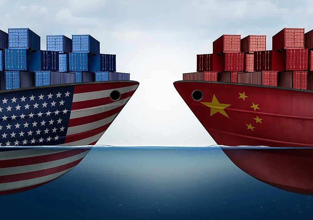
What is a Trade Embargo?
Published on 2019-11-04
Which Two Countries Used to Have the Same Flag?
Published on 2019-09-16
What Is the Only Two-Sided State Flag?
Published on 2019-09-16
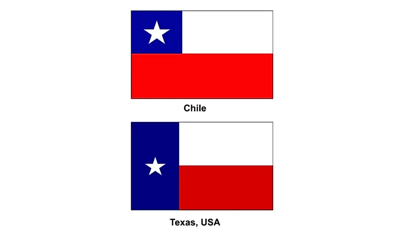
Which Country Flag Looks Like the Texas Flag?
Published on 2019-08-29
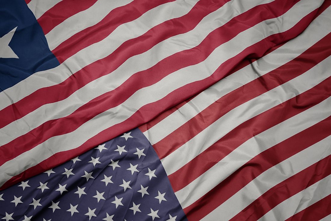
Flags That Resemble the US Flag
Published on 2019-08-20