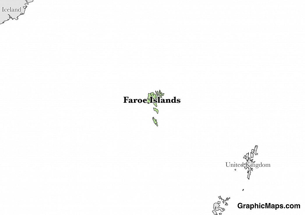
Where is Faroe Islands?
Located in Northern Europe, Faroe Islands is an island nation. It has a 1,117.00 km coastline. In the past, Faroese proposals for full indepedence have been deferred.
The capital of Faroe Islands is Torshavn. It is the largest city on the island and also one of the world’s smallest cities. It is located on southeast coast of Streymoy with Mount Húsareyn to the northwest and Kirkjubøreyn to the southwest. Torshavn existed during the time of the Vikings and was named after Thor, the god of thunder among the Norsemen. The name means Thor’s harbor. The capital’s population is about 18, 674 people with the second largest and third largest cities being Klaksvík and Runavík with 4,817 and 3,832 respectively. The main attractions in Torshavn are Nordic House, Faroese Museum of History, Faroese art museum, Valley of Saksun, Saga Museum, Torshavn Cathedral, Viking farmstead, Torshavn harbor, Fort Skansin, and Gasadalur waterfall. The climate of the capital is subpolar oceanic climate mainly highlighted by its northerly position. With 2.4 hours of sunshine per day, it is one of the cloudiest places in the world. During the summer, temperatures range from 12 °C while winter season has temperatures ranging about 6 °C. The absence of ice in the water masses and the cloudy skies contribute to the lack of severity of the low temperatures in winter. The warm month of the year is August while the coldest is February. Mean monthly rainfall is significantly high during fall and winter and highest in January because of the harsh storms moving through the region from the North Atlantic Ocean. Exceptionally drier periods occur in May and June.
Read more on Faroe Islands's CapitalFaroe Islands is a European country covering 1,393.00 km2. and about 2 times smaller than Rhode Island. Its geographic coordinates are 62 00 N, 7 00 W and Torshavn is the capital city.
The archipelgo's name is said to come from the Old Norse word "faer", which means sheep.
Its ISO code is FO.
Geography
Faroe Islands has a mean elevation of 0 m above sea level.
It experiences mild winters and cool summers, with foggy and windy patches all year round. Its terrain is rugged, with cliffs along most of the coast.
Population
Faroe Islands has a population of 50,456 making it the 210th largest in the world. The majority of the country lives on the island of Streymoy.
Faroese is spoken by the majority of the population. Major ethnic groups reported include Faroese and Danish. The majority of the population is Christian.
The official language of the Faroe Islands is Faroese. It was named the official language after the WWII in 1948. Before that, it had been used as a medium of instruction in schools in 1937 and churches in 1938. Before Faroese was adopted as the official language, Danish was widely used. However, even today, Danish still holds the same official status as Faroese in public relations because the island is within the Danish territory. In the 1980s, Faroese was already being used in the media. It is the smallest language in the North Germanic language branch of the West Scandinavian languages. Faroese is used by about 48,000 people of the whole island population, which is approximately 90.8%. The second language spoken is Danish, which is taught to students in their early years. English is also widely used by the young people. Other languages are Swedish, Norwegian and Icelandic which represent 0.09%, 0.2%, and 0.4% of native speakers respectively. 87 nationalities are found on the island. The Faroese language is closely related to Icelandic language. To some extent, speakers of both languages can understand one another. Minority languages include Norwegian, Filipino, Iceland, Spanish, Russian, and Chinese among other.
Read more on Faroe Islands's LanguagesThe dialing code for the country is 298.
Government
It is part of the Kingdom of Denmark. Its constitution was last ratified in 2005.
The Faroe Islands are a self-governing member of the Kingdom of Netherlands. The Home Rule Act of 1948 had two sections that specified the matters that the parliament, which is known as the Løgting, could handle. The first list enumerated the issues that the Faroese could take over while the second list specified those that had to be subjected to further negotiations between the islands and the Netherlands. For example, defense and foreign policy issues are out of the islands’ scope. The members are elected to four-year terms, and shortly after that, they elect the Prime Minister. Legislative power is shared between the Løgting and the Prime Minister while Executive power is held by the government which is made up of the Prime Minister and the Cabinet. Although the High Commissioner has a seat in the Løgting and gets to contribute in matters that are common to both Faroe Islands and Denmark, he does not vote. Two Faroese are elected to represent the islands in the Danish Parliament.
Read more on Faroe Islands's GovernmentEconomy
Factoring in Purchasing Power Parity, Faroe Islands's GDP is $2,001,000,000.00 (USD) with $40,000.00 (USD) per capita. This makes it the 196th largest economy and its citizens the 41st richest in the world. The currency of Faroe Islands is the Krone (DKK).
Its major export partners are Russia, the United States, and the United Kingdom. Its main exports are fish and fish products. Its major import partners are Denmark, Norway, and Germany. Its major imports include goods for household consumption, machinery and transport equipment, and fuels.
Flag
The Merkio is the official flag of the Faroe Islands. The flag has a short but dramatic history. Merkio was unveiled in 1919, when the flag was designed by two Faroese students who were studying in Copenhagen. The design was based on the traditional Nordic style of crosses and colors native to the region. The flag was officially recognized in 1948 by Denmark. Before the new design, the Faroe Islands had two unofficial flags that were used in functions and local ceremonies.
Read more on Faroe Islands's FlagThis page was last modified on January 17th, 2018
More on Graphicmaps
Published on 2019-11-06
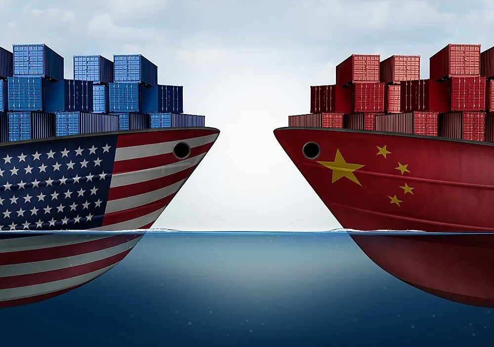
What is a Trade Embargo?
Published on 2019-11-04
Which Two Countries Used to Have the Same Flag?
Published on 2019-09-16
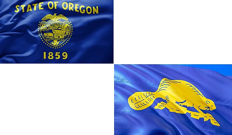
What Is the Only Two-Sided State Flag?
Published on 2019-09-16
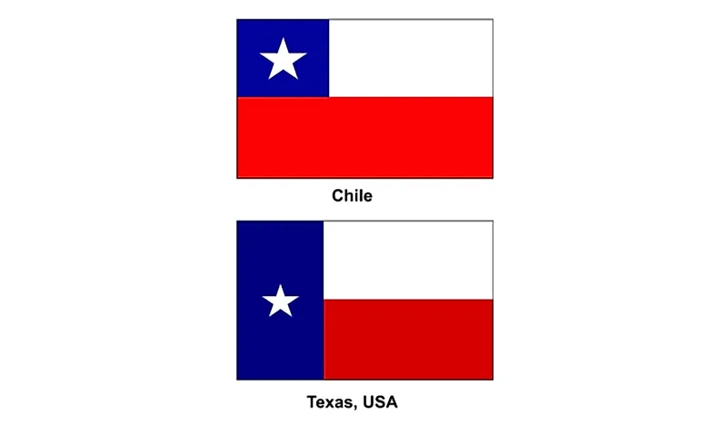
Which Country Flag Looks Like the Texas Flag?
Published on 2019-08-29
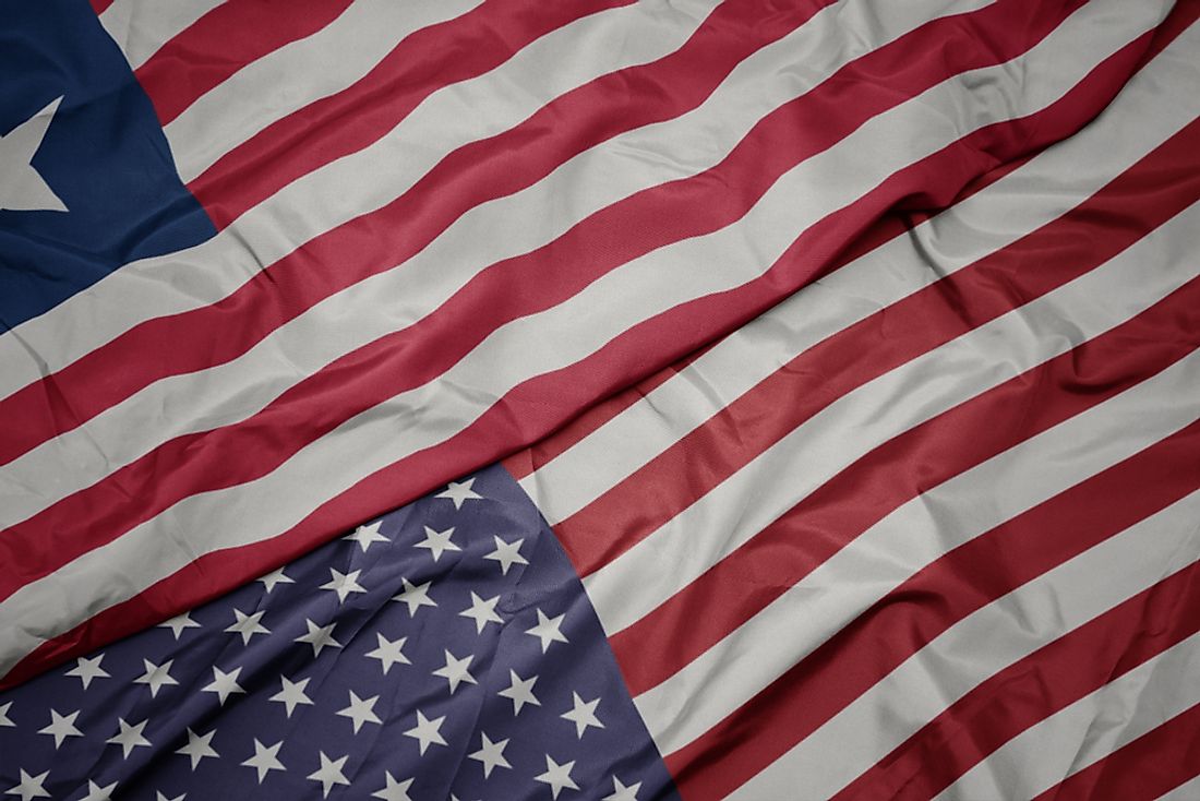
Flags That Resemble the US Flag
Published on 2019-08-20